
A GPS Angular camera app to get various stamps on photos
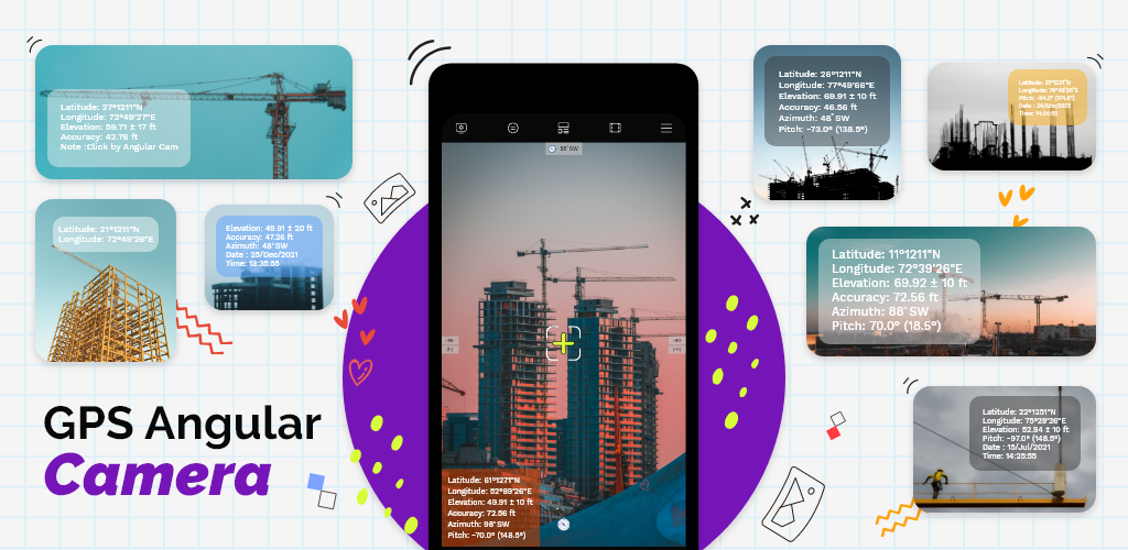
Angular Camera is a scientific camera application integrated with GPS information (including latitude, longitude, altitude, and accuracy), pitch angles, and azimuth angles. In addition, Angular Cam can leave text messages, or short notes and put all information together into a photograph.
You can add your field project with its whole title & related heading as the project name. With best of it you can also provide company name info into stamps. Enter your desired text to leave a message or caption into photos. This application allows you to save your locations; Save GPS coordinates, save latitude and longitude on maps, with significant Compass with Geo-Location.
Measure map GPS Coordinates and measure the pitch angle with defined horizon elevation in photos. Take a photo from a camera on your favorite place with a GPS Map camera stamp application for future use. There is an option in the camera settings to add a timestamp over the photo when taken. If your smartphone does have the timestamp feature, Read More »